A new scientific study indicates that southwestern B.C. faces some little-understood threats from earthquakes -- not just from the Big One, but from weaker quakes occurring within 100 kilometres of Vancouver. The implications for construction safety codes could be important, especially for the seismic retrofit program that's been strengthening B.C. schools.
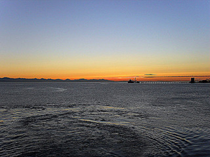
The report, published today in the Bulletin of the Seismological Society of America, finds that the geology of the Georgia Basin tends to slow down waves from nearby crustal earthquakes, causing longer, more intense shaking. The basin underlies the Straits of Georgia and Juan de Fuca, as well as Puget Sound, and much of Greater Vancouver is built on it.
Dr. Sheri Molnar of the University of British Columbia's department of civil engineering is the lead author of the report. She and her colleagues wanted to see how the basin's geological structure might influence the intensity of a quake in Greater Vancouver. They chose one spot 40 km west of the city, another beneath San Juan Island, 80 km south, and a third 80 km east-southeast near Deming, Washington. All three have shown recurrent seismicity, but have no known geological faults.
The researchers made some assumptions about the kind of faults that could have generated those earlier earthquakes, and then calculated what the effect would be if an event like the 6.7 Northridge, California quake of 1994 occurred in these locations.
The Georgia Basin has been filling up with rocks and sediments for a couple of million years. Greater Vancouver is largely built on those rocks, but they have been compacted by bearing the weight of the last few glaciations. Elsewhere, the basin is relatively soft. This is where a problem arises, Molnar said.
Focusing the quake
"Waves increase as they travel from stiff materials to soft," she said. "The waves can even resonate" -- that is, two waves may overlap and form a much larger wave.
The structure of the Georgia Basin also tends to focus the surface waves caused by a quake. "Overall," the report says, "the amplitude and duration of shaking is increased within the basin; focusing of surface waves in the narrow and deep southeast portion of the basin causes high-amplitude surface waves."
In other words, the heaviest, longest shaking would occur just off the Fraser River delta and western Vancouver. Richmond and Ladner would feel the impact, Molnar said, and soil liquefaction could result -- that is, the ground could turn to loose mud, unable to support the weight of the buildings resting on it.
Buildings across Greater Vancouver would experience "strong to very strong shaking" -- the kind that creates highly visible damage. On the Modified Mercalli Intensity scale, this shaking would hit levels VIII (destructive) to IX (violent). Some structures would collapse or suffer considerable damage.
The structure of the Georgia Basin would make matters worse, Molnar found. If the basin didn't exist, the scenarios showed, earthquake waves would pass quickly through Richmond and Ladner. But the basin increased the duration of moderate and higher shaking by eight to 15 seconds.
Averaging the outcomes of "events" at all three sites, the study finds that the Georgia Basin "significantly increases the level of periodic long-period ground motions" -- meaning "very strong to severe shaking MMI VIII-IX."
Gone in 40 seconds
Molnar said that this shaking could last for up to 40 seconds. That's not long compared to the minutes of violent shaking that a 9.0 quake could cause, but it's long enough to inflict considerable damage -- especially on weaker older buildings. To counter the threat, the B.C. Seismic Mitigation Program is gradually strengthening school buildings in the Lower Mainland, the Sunshine Coast, and on Vancouver Island.
Molnar also noted that the present Seismic Retrofit Guidelines don't specify the time that a structure is expected to withstand shaking. To look into that issue, The Tyee contacted Graham W. Taylor, a seismic consultant and a member of the Association of Professional Engineers and Geoscientists of B.C.
Taylor said retrofits have to consider three different types of quakes, each with typical shaking times. Shallow crustal quakes, like the ones Molnar's paper discusses, normally cause about 20 seconds of shaking in a given location. Subcrustal quakes, like the Nisqually earthquake of 2001, last about 45 seconds, and a subduction quake (the Big One) would cause shaking for 60 seconds or even longer.
Seismic upgrading, he said, has to consider all three. "We pick typical earthquake records to match our seismicity model," he said. While a subduction quake would occur off the west coast of Vancouver Island, it would still be felt in the Vancouver region. So Vancouver-area school upgrades have to factor in likely shaking times -- "40 seconds is short for a subduction quake," Taylor said.
But duration is significant, he added, and Molnar's paper would be carefully reviewed in developing the new set of retrofit guidelines which will begin development starting this spring, with publication in fall 2017. The subduction-quake hazard will be dominant, Taylor said, which means duration of weaker quakes will be automatically factored in.
'Just a first step'
While the Molnar study is an important advancement in understanding earthquake hazards in B.C., it also indicates how much more needs to be learned. "We knew the basin existed," Molnar said. "Now we know it intensifies earthquakes by three to four times." The effects are strongest in quakes coming from the south and southwest, though not from the north.
"We've just made a first step," Molnar said, pointing to California, where teams of researchers are creating modern hazard maps based on different models.
Similar research clearly needs to be done in B.C. -- not only to ensure good data for strengthening old school buildings, but for all major construction in the Lower Mainland and Vancouver Island. But governments may need a good shaking to awaken them to the need. ![]()
Read more: Science + Tech, Environment






Tyee Commenting Guidelines
Comments that violate guidelines risk being deleted, and violations may result in a temporary or permanent user ban. Maintain the spirit of good conversation to stay in the discussion.
*Please note The Tyee is not a forum for spreading misinformation about COVID-19, denying its existence or minimizing its risk to public health.
Do:
Do not: