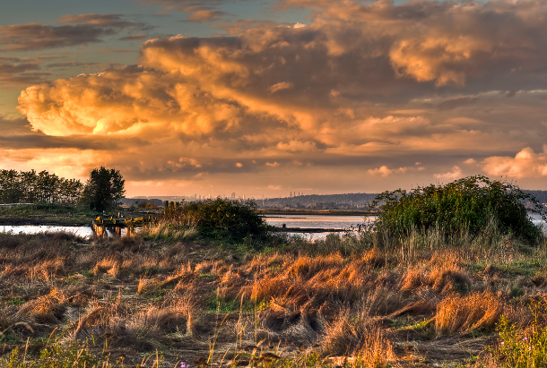
Crescent Beach is a sleepy beachfront community thrust into battle. With its sweeping ocean coastline and dramatic views of Boundary Bay, it has been home to people for nearly 3,000 years. But today's residents find themselves besieged by climate change and its tidal onslaught.
Streets lined with well-maintained bungalows and newer multi-million dollar homes lead to a sandy shoreline, fortified. The primary defences are a ring of elevated earthen dikes, protected from storm surges on the ocean side by boulders. Jutting out to sea from there are about 20 heavy plastic structures angled to break the energy of incoming waves.
None of this is enough to stop the deluge.
During the stormy winter months, the groundwater becomes so inundated with ocean water that pools collect and persist over much of the neighbourhood. The ocean dikes have a core of impermeable clay, but the water sweeps in with the tides through the underlying sand. As ocean levels rise, the groundwater is rising in unison with the tides, to the point where the water table resides at the surface.
In its war with the sea, the City of Surrey is spending $30 million to dig up the streets of Crescent Beach -- to lay perforated storm sewer pipes (with holes drilled throughout) to attract and drain groundwater. The plan is to collect this water, channel it to a newly-constructed pump-house, and send it back to the sea. At the same time, the entire community, where no one has a basement, is being raised up -- all of the newer homes, the roads, and eventually, all of the dikes.
"We all talk about climate change, but Crescent Beach is a case where it's already here," says Victor Jhingan, who is supervising the construction for the City of Surrey. "And we have to act now."
Surge emergencies
The impacts of sea level rise are uneven and will vary by geographical area. Where it will hit hardest in B.C., according to a 2013 summary of research, are the coastal floodplains of the Fraser River Delta. There, winter storm surges consisting of big waves and high winds, and seasonal freakishly-high "king tides," will increasingly work in concert with sea level rise to threaten coastal communities like Crescent Beach.
Global mean sea levels are rising by about three millimetres a year, double the rate during much of the 20th century. Water expands as it gets warmer. That and melting glaciers are causing most of the rise, with no end in sight barring a radical reduction of greenhouse gas emissions, according to the UN Intergovernmental Panel on Climate Change.
Still, just a few millimetres annually -- isn't that a tiny bump?
"You won't notice three millimetres of sea level rise a year, but it's not this slow process that is damaging," says John Clague, director of the Centre for Natural Hazards Research at Simon Fraser University. "It's the rare perfect storms where you have extreme high tides, and a storm creates a surge that elevates the water plane."
King tide events recently overtopped coastal dikes in both West Vancouver and Crescent Beach. Just this week, Vancouver city crews began to pile sandbags on local beaches to defend against a wave of expected king tides.
Big, soggy price tag
Metro Vancouver, home to roughly half of British Columbia's population, got a collective shock in 2012 when a provincial study predicted it would cost about $9.4 billion to prepare the region for a one-metre sea level rise expected by 2100.
Surrey's utilities manager Jeff Arason thinks that number is overstated, because it is based on defending against the ultimate perfect storm. Still, his city is ahead of most Lower Mainland cities in planning for sea level rise. And with good reason. Along its entire northern boundary is the Fraser River, which is influenced by ocean tides and subject to spring freshets. Two internal rivers, the Nicomekl and Serpentine, also drain into the ocean and swell with storm events and freshet.
The ocean coastline will increasingly be battered by storm surges and higher seas, which means the battle to protect places like Crescent Beach and neighbouring Mud Bay is just beginning.
"A thing like this can't fall to the local government to deliver," says Arason, noting that Surrey's dikes protect ports, railways, and highways of provincial and national significance. "It can't be expected that local government will pay the bill to protect all this other infrastructure."
You've probably already paid some, however. Take the aptly named Sea Island in Richmond, the floodplain home to Vancouver International airport. Every time you pay the airport improvement fee, a portion goes to climate change adaptation -- in this case, ongoing improvements to the dikes, which are being raised to 4.7 metres across much of the 25-kilometre island perimeter.
Richmond is a low-lying municipality where flood control and protection has been a preoccupation for more than a century. Today all property owners must pay a utility charge of $100 a year (generating about $10 million annually), which is dedicated for dike upgrades, pump stations and improvements to the drainage system.
The municipality is well on track to raise its dikes to nearly five metres above sea level to prepare for sea level rise by 2100. Meanwhile, the entire city is in the process of building upwards -- for all new homes, for example, the floor level must be at least a foot above the highest crown of adjacent road.
John Irving, Richmond's director of engineering and public works, estimates it will cost $300 million in today's dollars to do all the dike upgrading necessary to protect Richmond from the 100-year sea rise scenario.
"It's very doable," he says. "The big myth out there is that we're New Orleans."
Managed retreat?
The challenge with raising dikes is that for roughly every metre they rise, anywhere from four to six metres of property, often private, are required to broaden their bases, and that gets expensive. Clague says that the cost of continually raising the dikes "will become astronomical" as time goes on.
It's not the only option, however. The Tsawwassen First Nation has the added protection of a breakwater -- a man-made island just offshore that absorbs storm surges. And with inspiration from places like Copenhagen, more ecosystem-friendly approaches that use natural buffers have already been employed to low-lying coastal areas at Vancouver's Jericho Beach and sections of West Vancouver's Ambleside sea wall.
A more radical response to sea level rise is "managed retreat" -- where government opts to buy out property owners and abandon a site to the sea. In the province's 2012 Adaptation report, this was presented as a "viable option" for Mud Bay, a vulnerable Surrey floodplain used primarily for dairy farming, immediately to the north of Crescent Beach.
The province raised the possibility of similar retreats for a few sites in Delta, including Tsawwassen Beach, where the cost of protecting a single row of homes from storm surges is so great, it may eventually be preferable to relocate the residents. Victor Jhingan is no fan of that option. “You go stand up at a community meeting and suggest it," he laughs.
Then again, a hard rain can wash away old assumptions. Deborah Harford, executive director of Simon Fraser University's Adaptation to Climate Change Team, notes that Copenhagen became a leader in urban flood control after catastrophe spurred action. Harford says such events are dubbed "decision-making rains" for their power to shift attitudes about change. It might take the same here. "I don't think we've had enough impact here to really feel an urgency on it yet." ![]()
Read more: Environment


Tyee Commenting Guidelines
Comments that violate guidelines risk being deleted, and violations may result in a temporary or permanent user ban. Maintain the spirit of good conversation to stay in the discussion.
*Please note The Tyee is not a forum for spreading misinformation about COVID-19, denying its existence or minimizing its risk to public health.
Do:
Do not: